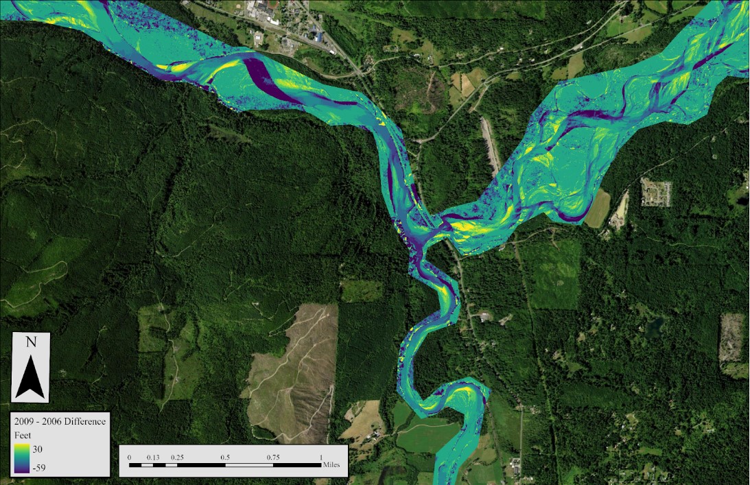
LiDAR Change Detection
LiDAR data was used to detect stream and forest change in the Northfork River.
I am a graduate of the College of the Environment at Western Washington University with a drive and passion for knowledge and a collaborative spirit. I have expertise with current environmental practices (especially GIS and mapping) and problem solving skills. I am open to new ideas and learning from my peers to better my own abilities. Intrigued by the many facets that GIS encompasses and excited for the constant advancements and interpretations with the software, I am diligent and deadline-driven, ready for challenges and problems that come my way.
LiDAR data was used to detect stream and forest change in the Northfork River.
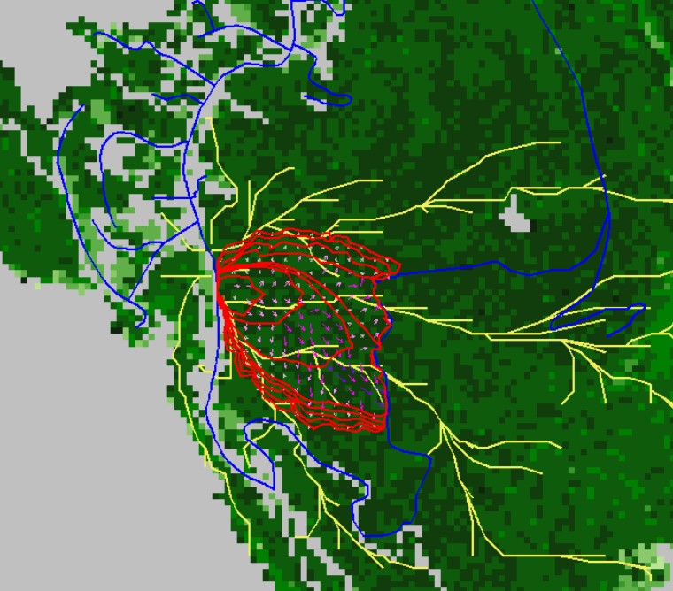
Using Mark Finey's SPLAT techniques on fire mitigation, my team and I found where best to perform these techniques in the Chuckanut Mountains using a program called FlamMap.
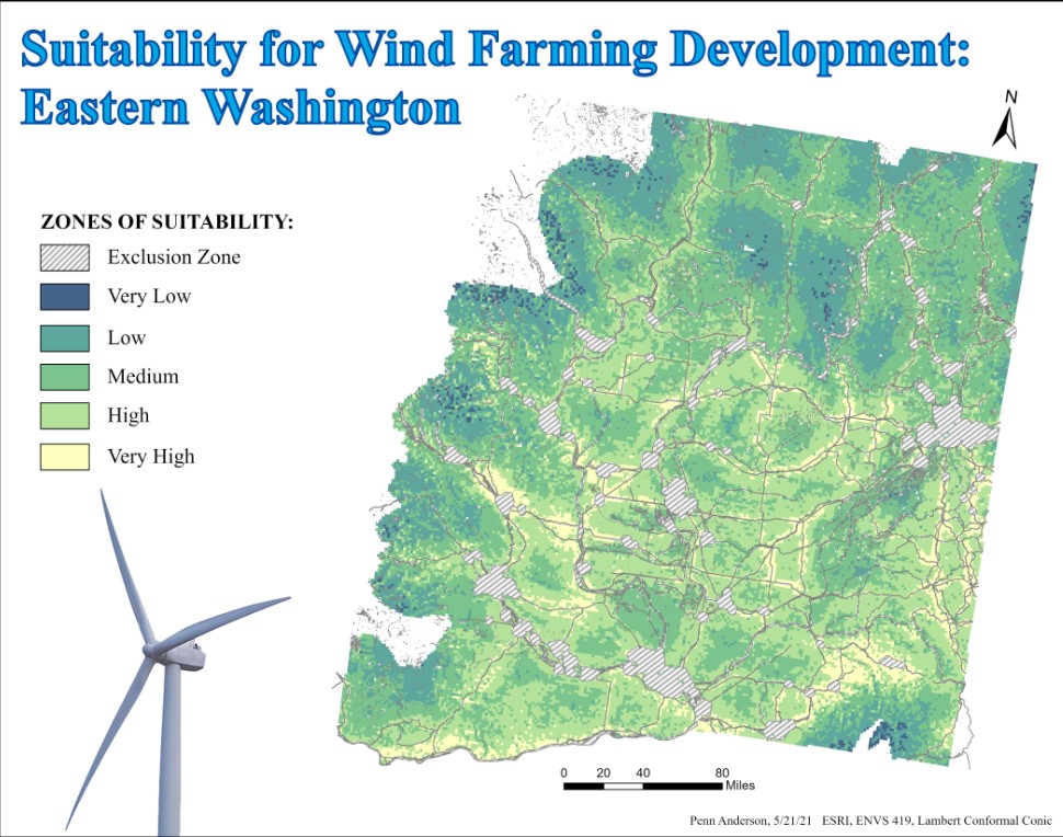
A suitability assesment was used to figure out where wind farms could be located in Eastern Washington.
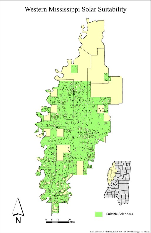
A suitability assesment was used to figure out where solar cells could be placed in Western Mississippi.
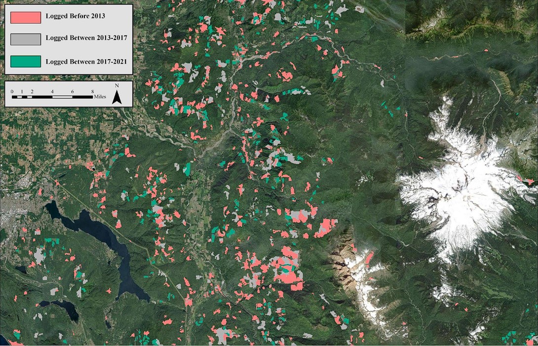
I found which unsupervised classification method (TCT or NDVI) produced the best outcome for logged areas throughout 2013 - 2021.
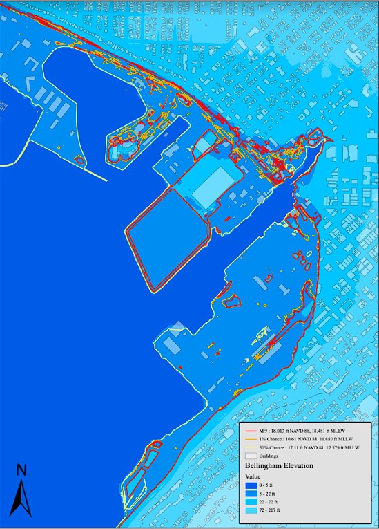
Potential sea level change is a rising threat to the coast lines. Here is a look into possible levels and reach of impact.